What is GPS? A Comprehensive Guide to Global Positioning Systems

GPS, the acronym for Global Positioning System, is a technology that has become so ingrained in our daily lives that we often take it for granted. From navigating city streets to tracking fleets of vehicles, GPS is the silent force guiding us. But what is GPS truly, and how does this revolutionary system function?
In essence, GPS is a satellite-based radionavigation system operated by the United States Space Force. It provides precise location and time information anywhere on or near the Earth where there is an unobstructed line of sight to four or more GPS satellites. Whether you’re using a smartphone, a dedicated navigation device in your car, or even sophisticated tracking equipment, GPS technology is at its core, enabling seamless navigation, location tracking, and a multitude of other applications.
This article delves into the intricacies of GPS, exploring its operational mechanisms, historical roots, diverse applications, and future trajectory. Understanding what GPS is and how it works is crucial in today’s technologically driven world, especially for industries like automotive repair and diagnostics where precision and location data are increasingly important.
Decoding GPS: How Does it Work?
The magic behind GPS lies in a sophisticated interplay between satellites, ground control stations, and user devices. At its heart, GPS operates on the principle of trilateration, a method of determining absolute or relative locations of points by measurement of distances, using geometry of circles, spheres or triangles.
The Three Segments of GPS
To fully grasp what GPS is, it’s essential to understand its three fundamental components, often referred to as segments:
-
Space Segment (Satellites): This segment comprises a constellation of at least 24 operational satellites orbiting the Earth at an altitude of approximately 12,550 miles (20,200 km). These satellites are not geostationary; instead, they are arranged in six orbital planes, ensuring that at any point in time, multiple satellites are visible from virtually any location on Earth. Each satellite continuously transmits radio signals containing its position and the precise time the signal was sent, thanks to onboard atomic clocks.
.png)
Satellite Ranging: Illustration depicting how GPS devices calculate distance from satellites using signal travel time for trilateration. -
Control Segment (Ground Control Stations): This network of ground facilities is responsible for monitoring and controlling the satellites. The control segment consists of:
- Master Control Station: Typically located at Schriever Air Force Base in Colorado, it oversees the entire GPS system.
- Alternate Master Control Station: Serves as a backup.
- Monitor Stations: Globally distributed stations track the satellites’ signals, collecting ranging data and atmospheric information.
- Ground Antennas: Transmit commands and data to the satellites for orbit adjustments, time synchronization, and message uploads.
-
User Segment (GPS Receivers): This encompasses any device equipped to receive and process GPS satellite signals. This includes everything from smartphones and in-car navigation systems to specialized GPS receivers used in surveying, agriculture, and, importantly, automotive diagnostics. These receivers calculate their position by measuring the time it takes for signals to arrive from multiple satellites.
Trilateration in Action
GPS technology hinges on trilateration to pinpoint location. Here’s how it works step-by-step:
- Signal Reception: A GPS receiver on Earth picks up signals from multiple GPS satellites.
- Distance Measurement: By measuring the time delay between when a signal was transmitted by a satellite and when it’s received, the GPS receiver calculates the distance to that satellite. Since radio waves travel at a known speed (the speed of light), the time delay directly translates to distance.
- Position Calculation: Distance from a single satellite places the receiver somewhere on the surface of a sphere centered at that satellite. With signals from multiple satellites, these spheres intersect.
- Three Satellites for 2D Position: In theory, signals from three satellites are sufficient to determine a two-dimensional position (latitude and longitude). The intersection of three spheres narrows down the location to two possible points. One of these points is usually easily discarded as being far from the Earth’s surface.
- Four Satellites for 3D Position and Accuracy: A fourth satellite is crucial for resolving ambiguity and providing altitude information, thus enabling a precise three-dimensional position. The fourth satellite also enhances accuracy by providing redundancy and improving the geometry of the satellite constellation relative to the receiver.
The Multifaceted Uses of GPS Technology
Understanding what GPS is also means recognizing its vast array of applications. Initially developed for military purposes, GPS has rapidly permeated civilian life, transforming numerous industries. For automotive professionals at CARDIAGTECH, understanding these applications is particularly relevant.
Here are five primary uses of GPS:
- Location: Determining precise geographic positions. This is the foundational use, allowing devices and users to know exactly where they are on Earth.
- Navigation: Guiding movement from one point to another. In-car navigation systems are a prime example, providing turn-by-turn directions.
- Tracking: Monitoring the movement of objects or individuals. Fleet management in logistics, vehicle recovery systems, and even fitness trackers utilize GPS for tracking.
- Mapping: Creating detailed maps and geographic data. Surveying, geographic information systems (GIS), and location-based services rely heavily on GPS for accurate mapping.
- Timing: Providing highly accurate time synchronization. Telecommunications networks, financial systems, and scientific research often depend on the precise timing signals from GPS satellites.
helicopter
GPS Use Cases Across Industries:
Beyond these core uses, GPS finds applications in a wide spectrum of industries:
- Automotive: Navigation systems, telematics, emergency services (eCall), usage-based insurance, autonomous driving development. For CARDIAGTECH readers, GPS is integral to modern vehicle diagnostics, telematics data analysis, and potentially future repair processes involving autonomous vehicles.
- Agriculture: Precision farming, automated machinery, yield monitoring.
- Construction: Surveying, equipment tracking, site management.
- Aviation and Maritime: Air and sea navigation, air traffic control, maritime safety.
- Public Safety: Emergency response, law enforcement, disaster relief.
- Logistics and Transportation: Fleet management, route optimization, delivery tracking.
- Mining: Surveying, equipment operation, safety monitoring.
- Scientific Research: Geodesy, atmospheric studies, environmental monitoring.
GPS Accuracy: Factors and Limitations
While GPS is remarkably accurate, it’s important to acknowledge that its precision isn’t absolute and can be influenced by several factors. Understanding these factors is crucial for anyone working with GPS data, including automotive technicians who might use GPS-based diagnostic tools.
Factors Affecting GPS Accuracy:
- Atmospheric Conditions: The ionosphere and troposphere can cause delays in GPS signals as they pass through the atmosphere, impacting accuracy.
- Satellite Geometry: The arrangement of satellites in the sky relative to the receiver (Dilution of Precision – DOP) affects accuracy. A wider spread of satellites generally leads to better accuracy.
- Signal Obstructions: Physical obstacles like buildings, trees, and mountains can block or reflect GPS signals, causing multipath errors and reducing accuracy. This is particularly pronounced in urban canyons.
- Receiver Quality: The quality of the GPS receiver and its signal processing capabilities influence accuracy.
- Intentional Degradation (Selective Availability – SA): Historically, the U.S. military intentionally degraded civilian GPS accuracy (Selective Availability). However, SA was discontinued in 2000, significantly improving civilian GPS precision.
Urban Canyons and GPS Accuracy:
Urban environments, with their tall buildings, present a significant challenge to GPS accuracy. Signals can be blocked entirely or reflected off buildings, creating “multipath errors” where the receiver gets signals that have traveled longer paths than the direct signal. This can lead to position errors.
Despite these limitations, modern GPS technology, especially when combined with augmentation systems like WAAS (Wide Area Augmentation System) or EGNOS (European Geostationary Navigation Overlay Service), can achieve accuracies of a few meters or even sub-meter accuracy in open sky conditions.
A Glimpse into GPS History
To truly appreciate what GPS is, it’s beneficial to know its historical roots. The genesis of GPS can be traced back to the Cold War era and the launch of Sputnik, the first artificial satellite, by the Soviet Union in 1957.
- Early Inspirations: American scientists, observing Sputnik’s radio signals, realized that by measuring the Doppler shift of the signals, they could track the satellite’s orbit. Conversely, if they knew the satellite’s orbit, they could determine their position on Earth.
- TRANSIT System: The U.S. Navy developed the first satellite navigation system, TRANSIT, in the 1960s, primarily for submarine navigation. TRANSIT provided position fixes every hour and was a significant step forward.
- System 621B and NAVSTAR: In the 1970s, the U.S. Air Force developed System 621B, and the Navy continued its work. These efforts converged into the NAVSTAR GPS program, officially initiated in 1973.
- Full Operational Capability: The first GPS satellite was launched in 1978. It took several years to build the full constellation. GPS was declared to have Initial Operational Capability in 1993 and achieved Full Operational Capability in 1995 with a complete constellation of 24 satellites.
- Civilian Access: While initially a military system, GPS was made available for civilian use in the 1980s, though with degraded accuracy due to Selective Availability. The removal of SA in 2000 marked a turning point, unleashing the full potential of GPS for civilian applications and paving the way for the GPS revolution we see today.
For a deeper dive into the historical evolution, resources like “History of GPS satellites and commercial GPS tracking” offer valuable insights.
GPS as Part of GNSS: A Broader Perspective
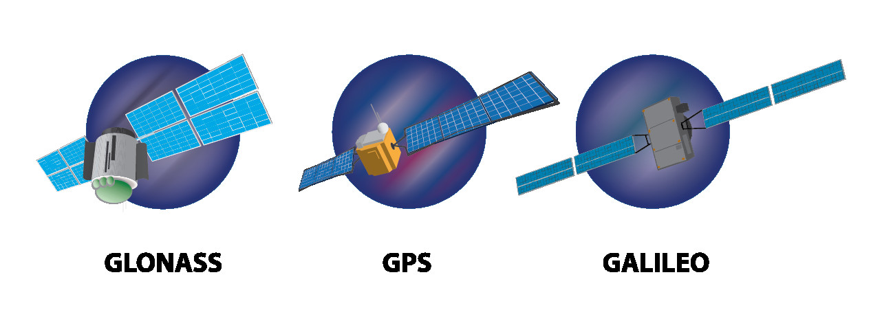
When discussing what GPS is, it’s important to understand that GPS is a specific implementation of a broader concept: Global Navigation Satellite System (GNSS). GNSS is the umbrella term for all global satellite navigation systems.
Currently, there are several GNSS systems either fully operational or under development:
- GPS (USA): The most established and widely used GNSS, officially named NAVSTAR GPS.
- GLONASS (Russia): Russia’s equivalent to GPS, GLONASS is also fully operational.
- Galileo (European Union): The EU’s GNSS, Galileo is operational and aims to provide even greater accuracy and reliability.
- BeiDou (China): China’s BeiDou system is now fully operational, providing global coverage.
 3 types of satellites
GPS vs. GNSS Receivers:
Often, the terms GPS and GNSS are used interchangeably in casual conversation. However, technically, there’s a distinction, especially when considering receivers:
- GPS Receivers: Specifically designed to receive and process signals only from the GPS satellite constellation.
- GNSS Receivers: Capable of receiving and processing signals from multiple GNSS constellations (e.g., GPS, GLONASS, Galileo, BeiDou). This multi-constellation capability offers several advantages, including:
- Increased Satellite Visibility: A GNSS receiver can access a larger number of satellites, improving accuracy, especially in challenging environments like urban canyons or under heavy foliage.
- Enhanced Reliability: If signals from one system are blocked or degraded, the receiver can rely on signals from other GNSS systems.
- Faster Position Fixes: More satellites in view can lead to quicker initial position acquisition.
 diagram
While GNSS receivers offer performance benefits, they can sometimes be more expensive and may have slightly higher power consumption than GPS-only receivers. However, the advantages in accuracy and reliability often outweigh these drawbacks, making GNSS receivers increasingly prevalent in professional and high-performance applications.
The Future of GPS and GNSS
The evolution of GPS and GNSS is ongoing. Countries worldwide are continuously investing in upgrading their existing systems and developing new capabilities. The future of satellite navigation promises even greater accuracy, reliability, and integration with other technologies.
Trends Shaping the Future of GNSS:
- Increased Accuracy: Ongoing improvements in satellite technology, ground infrastructure, and signal processing techniques are driving towards centimeter-level and even millimeter-level accuracy.
- Multi-Frequency GNSS: Newer GNSS systems and receivers are utilizing multiple frequency bands, which helps mitigate atmospheric errors and improve accuracy and robustness.
- Enhanced Integration: GNSS is becoming increasingly integrated with other sensors and technologies, such as inertial measurement units (IMUs), Wi-Fi, and cellular networks, to create more robust and seamless positioning solutions, especially in indoor and urban environments where satellite signals may be weak or unavailable.
- Autonomous Systems: GNSS is a critical enabler for autonomous vehicles, drones, and robotics. Future advancements will focus on ensuring the high integrity and reliability of GNSS positioning for safety-critical autonomous applications.
- LEO Satellites: The emergence of Low Earth Orbit (LEO) satellite constellations could complement traditional GNSS systems, potentially improving accuracy and availability, especially in urban areas.
For automotive applications at CARDIAGTECH, the future of GPS and GNSS is particularly exciting. More accurate and reliable positioning will be crucial for advanced driver-assistance systems (ADAS), autonomous driving, and even more sophisticated vehicle diagnostics and telematics services.
In Conclusion:
What is GPS? It’s a revolutionary technology that has transformed navigation, location services, and countless industries. From its origins in military applications to its pervasive presence in our daily lives, GPS has become an indispensable tool. Understanding its workings, applications, and future trajectory is essential for anyone involved in technology, and especially for professionals in the automotive field who are increasingly reliant on precise location data. As GNSS technology continues to evolve, its impact on our world will only continue to grow, driving innovation and shaping the future of mobility and connectivity.
Next Article:
Debunking the top 10 vehicle tracking myths